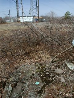
HIGH KNOB RM 2
Spatial/elevation data
| Coordinates | N 41.27047° W 75.369686° (estimate) |
| Elevation | Unknown |
| Location | Pennsylvania
Pike County Pecks Pond Quad |
Mark description
| Type | Reference Mark Disk |
| Setting | Rock Outcrop |
| Monumented | 1940 by NGS |
Narrative and photographs
For more information about this reference mark, see its parent mark HIGH KNOB.
Measurements given in the box score led us to the area where RM2 should be located, but we were unable to find the mark at this time. A rock outcropping in the correct spot is buried beneath soil and gravel that have frozen as hard as concrete and were impenetrable by the small trowel we had brought.

