WANNA RM 2
Recovered in Good Condition on May 26, 2014
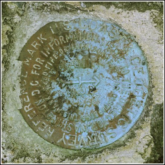
Spatial/elevation data
| Coordinates | N 41.22995° W 75.49335° |
| Elevation | 1878.94 ft. |
| Location | Pennsylvania
Monroe County Tobyhanna Quad |
Mark description
| Type | Reference Mark Disk |
| Setting | Boulder |
| Monumented | 1960 by NGS |
| Description (NGS) | NGS Datasheet |
NGS recovery information
Descriptive text
Recovered in good condition. The mark is located within Gouldsboro State Park. The station is most easily reached via the Old Route 611 Trail beginning at its intersection with PA Route 507. Walk southeasterly on the trail for about 0.2 miles to the station on the left and the reference marks on the right.Narrative and photographs
For more information about this reference mark, see its parent mark WANNA.
