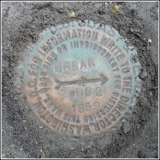
URBAN RM 2
Recovered in Good Condition on May 3, 2014
Spatial/elevation data
| Coordinates | N 41.359722° W 75.379611° |
| Elevation | 1389.43 ft. |
| Location | Pennsylvania
Wayne County Sterling Quad |
Mark description
| Type | Reference Mark Disk |
| Setting | Square Concrete Monument |
| Monumented | 1959 by NGS |
| Description (NGS) | NGS Datasheet |
NGS recovery information
Descriptive text
Recovered in good condition about one foot northwest of the northeast corner of a barn. The blacktop road is PA Route 191.Narrative and photographs
For more information about this reference mark, see its parent mark URBAN.


.")
.")