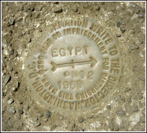
EGYPT RM 2
Recovered in Good Condition on July 10, 2004
Spatial/elevation data
| Coordinates | N 41.343183° W 75.211083° |
| Elevation | 1792.42 ft. |
| Location | Pennsylvania
Pike County Promised Land Quad |
Mark description
| Type | Reference Mark Disk |
| Setting | Square Concrete Monument |
| Monumented | 1959 by NGS |
| Description (NGS) | NGS Datasheet |
NGS recovery information
Descriptive text
Recovered in good condition. The power pole is numbered PP&L 12529/69706/N43874. The blazed tree was not found.Narrative and photographs
For more information about this reference mark, see its parent mark EGYPT.
This mark was found in good condition as described.


Recovered in good condition.
Reference mark EGYPT NO. 2 is set in the top of a square concrete monument about level with the ground, and is on Delaware State Forest land. (For photos and details how to reach this mark see: LY1169)
~Rich in NEPA~


