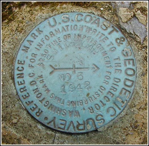
SMITHS GAP RESET RM 3
Recovered in Good Condition on March 14, 2004
Spatial/elevation data
| Coordinates | N 40.822867° W 75.422717° |
| Elevation | Unknown |
| Location | Pennsylvania
Northampton County Kunkletown Quad |
Mark description
| Type | Reference Mark Disk |
| Setting | Rock Outcrop |
| Monumented | 1942 by NGS |
Narrative and photographs
For more information about this reference mark, see its parent mark SMITHS GAP RESET.


